For my first hike of the new year, I met up with my good friend Ivan, and headed off to the area near Charlton Flats in the San Gabriels. Our mission for the day was to climb a cluster of 3 mountains: Vetter Mountain, Mount Mooney, and Devil Peak.
- Destination: Vetter Mountain, Mount Mooney, and Devil Peak
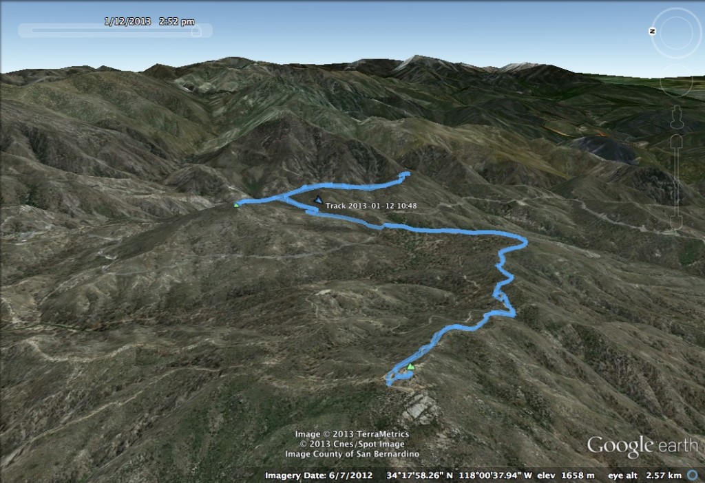
- Distance: 7.8 miles round trip, 2.1 miles up Vetter via HPS #1, 3 miles from Vetter to Mooney via HPS #1 and HPS #1, 1.5 miles between Mooney and Devil Peak by road and trail/bushwhack, and 1.2 miles down from Devil Peak
- Elevation: 5,940 ft for Vetter Mountain; 5,840 ft for Mount Mooney; 5,870 ft for Devil Peak
- Gain: 2,631 ft
- Starting Point: Charlton Flats turnoff on Highway 2 (Angeles Crest Highway), 9 mi past Red Box/Mount Wilson junction
- Time: 4h11 total → 1h23 up to Vetter Mountain, 1h17 from Vetter to Mooney, 0h48 from Mooney to Devil Peak, 0h43 down from Devil Peak
- Route Finding: Easy for Vetter Mountain and Mount Mooney, Difficult for Devil Peak
Route
Comments
We chose this route for it’s scenery — Vetter Mountain is one of the few mountains in the Angeles to have an unobstructed 360° view at it’s summit. For this reason, a fire watch tower sat on top of Vetter Mountain until the Station Fire. Although it has burned down, it’s foundation remains.
We had been planning to take the HPS #2 route up to the top of Vetter Mountain, but the vehicle gates in to the Charlton Flats Picnic Area were closed, which kept us away from the start of the route. Instead, we parked at the Charlton Flats turnoff from Angeles Crest Highway and took HPS #1 up. This route is largely a paved road hike, up until a short bit at the end which is dirt road, and finally a dirt path.
")
Unfortunately, as can be seen in the image above, the area suffered extensive fire damage in the Station Fire in 2009. However, there are still spectacular meadow views, and it is clear that the area has started to recover.
")
As mentioned above, the summit has a spectacular 360° vista that encompasses the high desert peaks, the San Gabriel front range, and the tall mountains over near the Baldy Bowl. We were lucky, as the weather was clear enough that we could see out across the LA basin to Catalina Island, and we could see Mount San Jacinto way off in the distance.
") Vetter Mountain Summit Panorama
Vetter Mountain Summit Panorama
After making it to the top of Vetter Mountain, we hiked back down to the Angeles Crest Highway. To get to Mount Mooney and Devil Peak, we crossed route 2 and went about 100 meters north. A paved road starts here, and turns into dirt about 0.1 mi later. This dirt road leads straight to a saddle, where the road continues off to the right, and a trail starts to the left. The trail is not marked but can be identified by a pair of signs that indicates that the area is off-limits to motorized vehicles.
Mount Mooney is an easy hike up, and presents spectacular views along the way. The summit is wooded, but there are several clear views along the trail that look towards Mount Baldy across the saddle between Mount Mooney and Devil Peak.
")
To get to Devil Peak, you head back across the saddle and follow the road towards an observatory. The road here has very nice views across a canyon.
")
Eventually, the road ends, and a faint trail heads up Devil Peak. We followed this trail into brush, where it went faint. From here, we bushwhacked our way up the mountain. It is very clear as to where the summit is, so once the trail dies off, just keep heading towards the high point. We did pick the trail back up, about 100 feet from the summit. Our navigation was complicated by snow on the ground — Devil Peak is more wooded and still had significant (but not deep) snow cover. Due to the thickness of the wood, the view at the summit is poor, but a nice vista can be found slightly to the south of the summit. This vista looks out over the San Gabriel front range.